The relative geographic extent of a hazard or assessment, ranging from small terrain features to entire mountain ranges.
Credit: Crested Butte Avalanche Center
Snowpack characteristics and avalanche hazards vary across spatial scales. The scale puts in context the relative extent of terrain for which assessments apply. Spatial scales can vary from micro (terrain features) to macro (mountain ranges).

Varying spatial scales illustrated in one photo. Credit: Crested Butte Avalanche Center
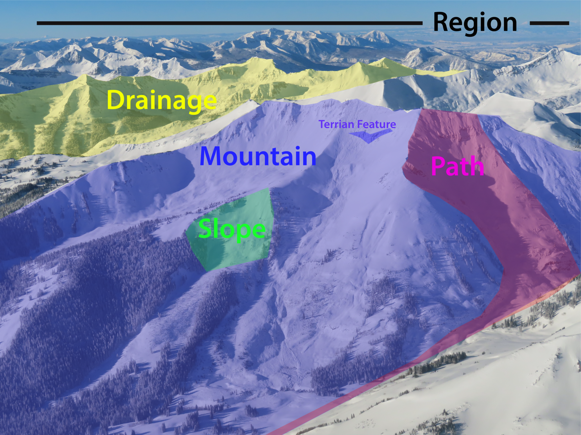
- Terrain Feature: Terrain features are individual geographic features contained within a larger slope, such as a rollover, a rock band, or a gully. Think of it as some part of the slope where you might slash a few turns.
Terrain features include rollovers, rock bands, a cluster of trees, a gulley, etc. Credit: Google Earth

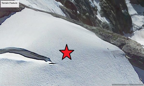
- Slope: Slopes are large, open, inclined areas with somewhat homogeneous characteristics bounded by natural features such as ridges, gullies, or trees. These could be typical avalanche starting zones or open areas on a ski run. Think of it as a pitch where you and multiple friends could all link together a dozen or more turns.

Zooming out to the slope scale. This slope is bounded by several terrain features such as the ridgeline and rock outcrops. Credit: Google Earth
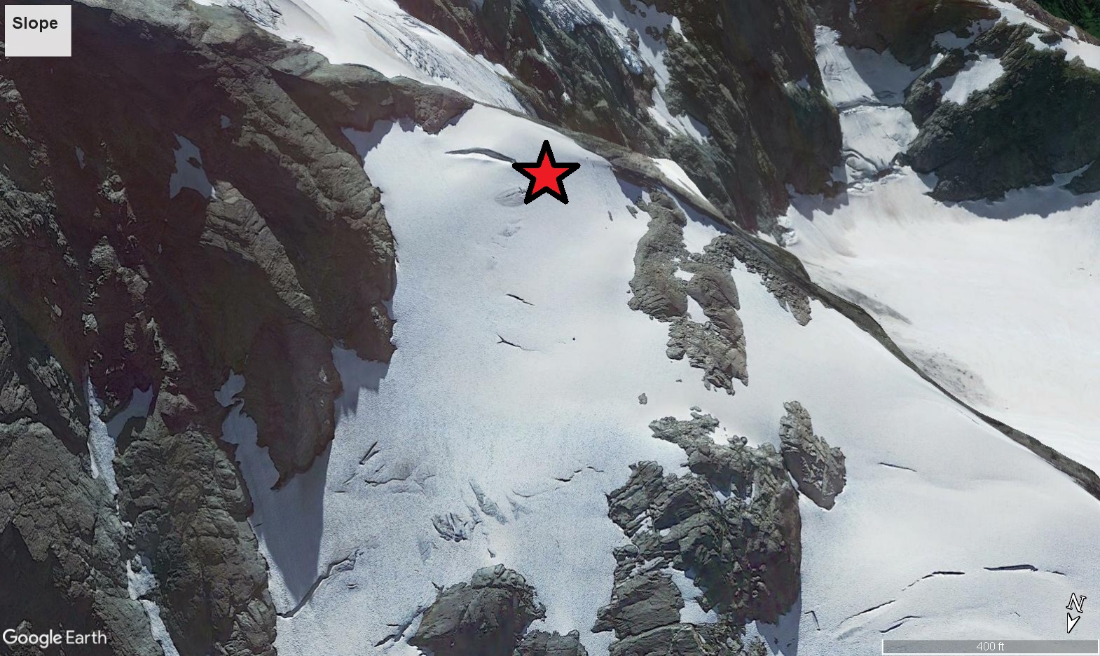
- Path: A path is a series of interconnected slopes and terrain features running from near ridge crest to valley bottom, such as a full-length avalanche path. Think of it as a long backcountry ski run.
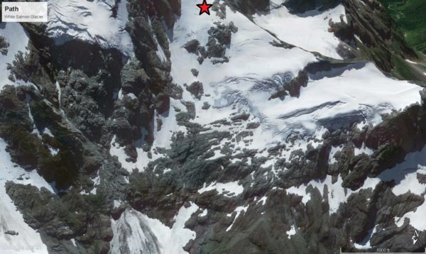
Zooming out to the path scale, where multiple slopes link together to form the White Salmon Glacier route. Credit: Google Earth

- Mountain: A mountain is an area rising considerably above the surrounding country with numerous aspects and vertical relief running from summit to valley bottom, such as a ski resort area or a peak. Think of it as an objective that could offer numerous descent options on different faces or paths.
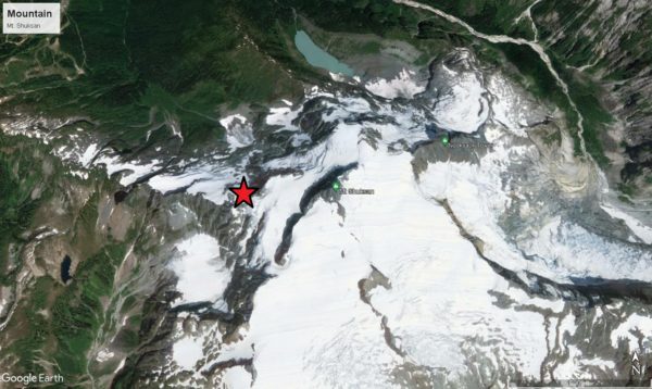
Zooming out to the mountain scale. Multiple faces drain off of Mt. Shuksan. Credit: Google Earth

- Drainage: A drainage is an area with a perimeter defined by the divide of a watershed, such as a typical single operating zone in a helicopter skiing area. Think of it as a basin large enough to spend most of a day snowmobiling without crossing your tracks.
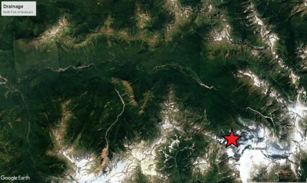
Zooming out to the drainage scale, where Mt. Shuksan is just one of numerous mountains draining into the North Fork of the Nooksack River. Credit: Google Earth

- Region: A region is a large area of multiple watersheds defined by mapped boundaries, such as a typical public forecasting area or public land jurisdiction. Think of it as an area where you would need multiple days snowmobiling to adequately see the terrain.
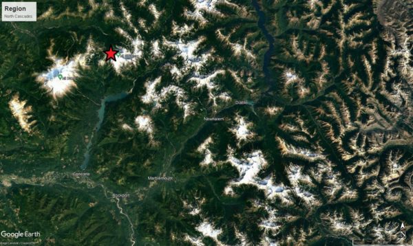
Zooming out to the regional scale. Here, numerous drainages make up the North Cascades Region.

- Range: A range is a geographic area containing a chain of geologically related mountains, such as a mountain range or sub-range. The range scale is large enough to span across state boundaries.

Zooming out to the range scale: the Cascade Range. Credit: Google Earth
