Route planning based on terrain characteristics.
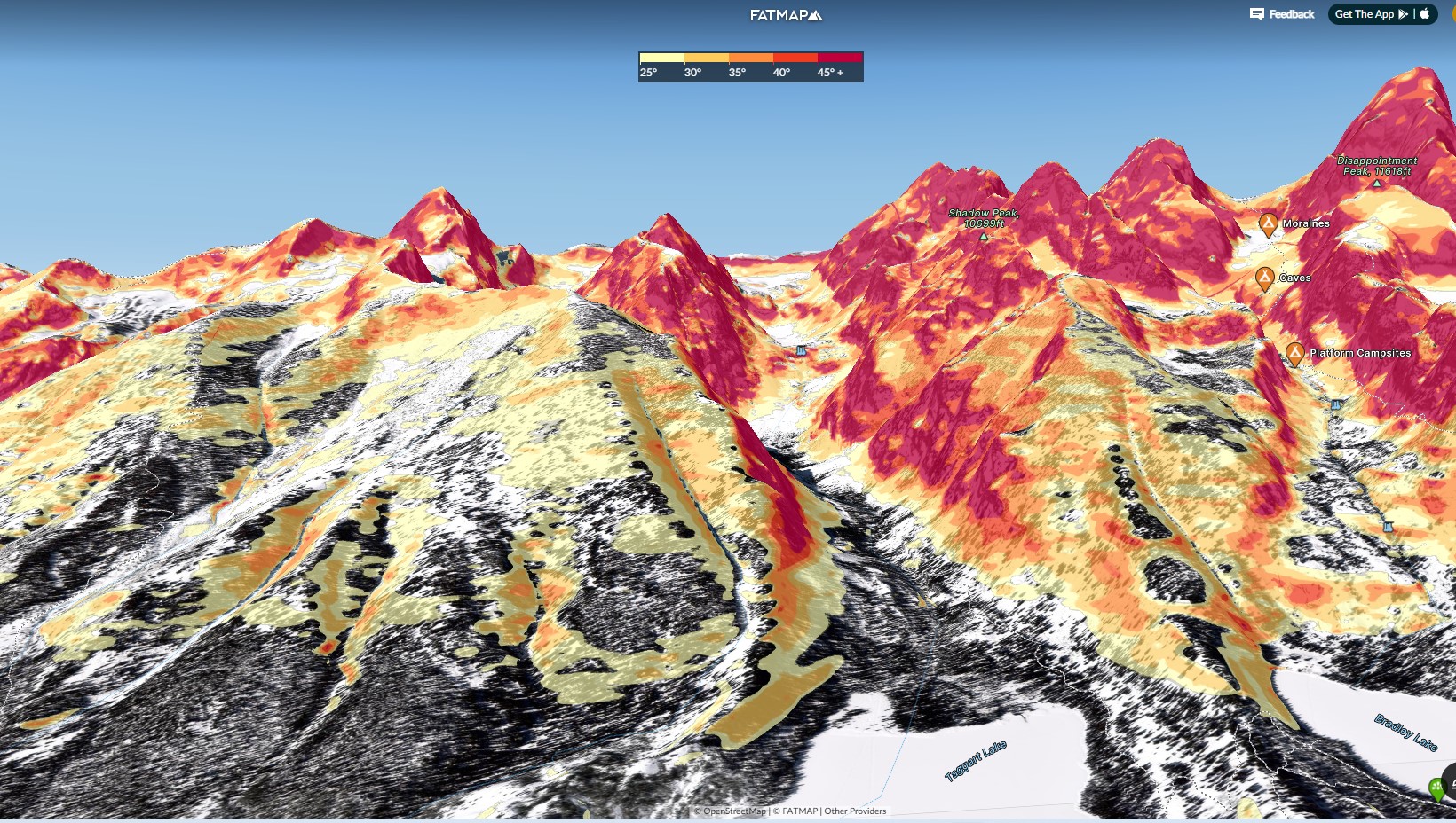
Credit: FatMap.com
You can increase your safety in the backcountry by planning your travel with a knowledge of the terrain characteristics. There are numerous resources for helping to visualize slope characteristics such as tree cover, aspect, slope angle, existence of terrain traps, etc. These include hard copy guidebooks, terrain atlases, and topographic maps. There are also numerous valuable online resources and apps such as Google Earth, CalTopo, FatMap, OnX, and Gaia. Though many online resources have helpful layers such as slope angle, you must recognize that the accuracy of these slope angle maps are limited by the resolution of the underlying data. That resolution may be too coarse to provide the accuracy needed for fail-proof terrain management in the field. Use them as a starting point for planning, but expect differences from actual slope angles and plan to take frequent slope angle measurements in the field.
Guidebooks and terrain atlases have photographs of terrain with route descriptions. Credit: Beacon Guidebooks
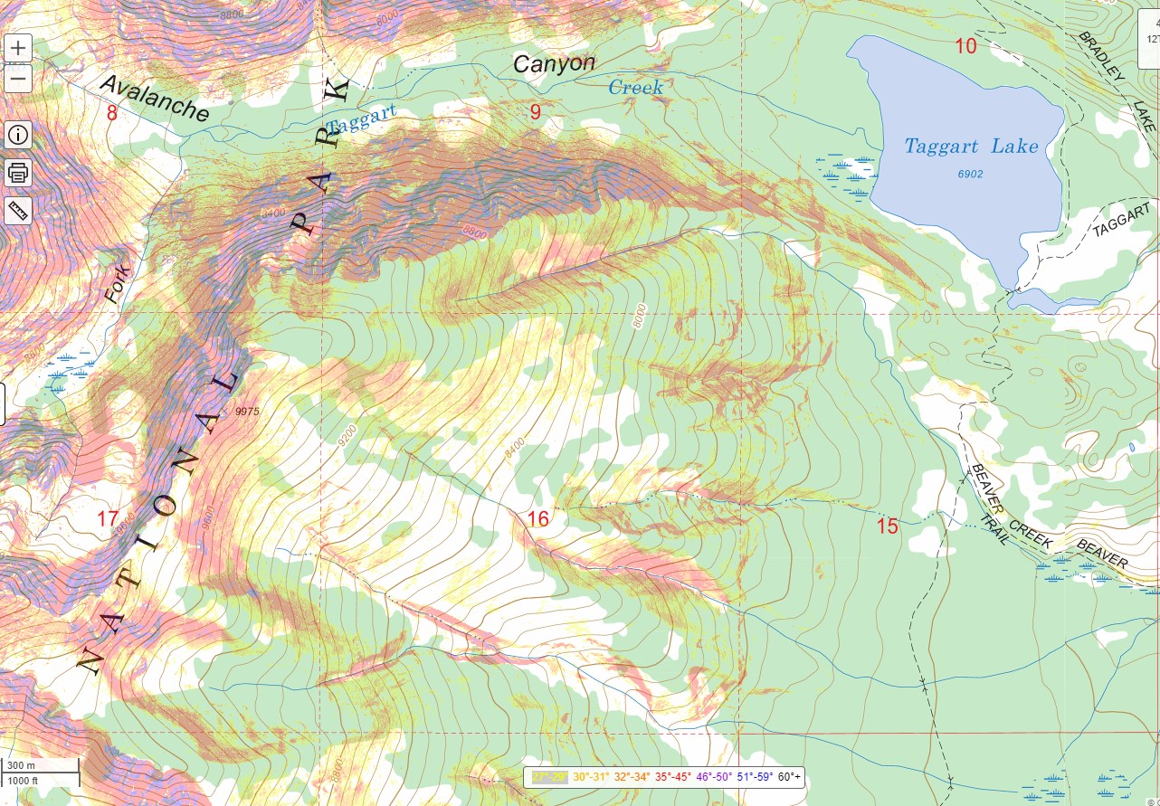
There are a number of online mapping tools that can produce slope angle maps or other useful layers. The accuracy of the slope angle map is limited by the resolution of the digital elevation model (DEM) used to create the map. The resolution of DEMs is improving in the U.S.; most datasets now have 10m grids or less. Credit: Caltopo.com
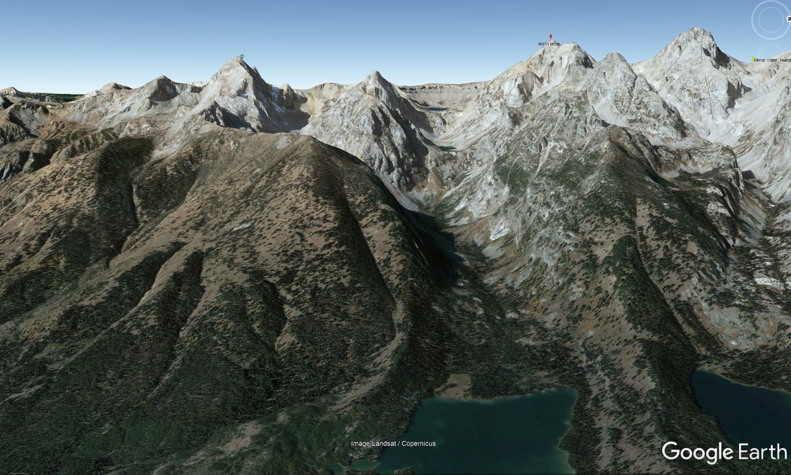
3D mapping programs like Google Earth or FatMap are additional tools for visualizing terrain. Credit: Google Earth