Enhanced precipitation caused by moisture rising over high terrain.

Credit: Encyclopedia Britannica, Inc.
The most basic form of orographic precipitation occurs when a deep layer of sufficiently moist air is forced over a terrain feature. The air mass expands as it rises, cooling the air and causing cloud and precipitation formation. The precipitation is focused on the top and windward side of the feature where the lift is greatest. As the air moves beyond the feature, the lift is gone, and a fair bit of the moisture is gone as well (precipitated out), thus precipitation diminishes. This orographic effect is part of the reason that snow totals are often significantly higher in mountains than in valleys. Orographic snowfall is most favorable if winds are oriented perpendicular to the crest of the mountain range. For example, Utah’s Wasatch Range runs north to south, so a westerly wind direction will produce good orographics. The orientation and shape of peaks, basins, and passes within a mountain range influence local orographic snowfall and account for differences in storm totals across the terrain. High resolution weather models, which incorporate more terrain details, tend to perform better at predicting patterns of orographic snowfall.
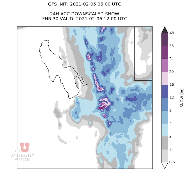
Modeled snowfall for a winter storm in Utah. The favored snow totals are along the Wasatch Crest, a result of orographic enhancement. Credit: University of Utah
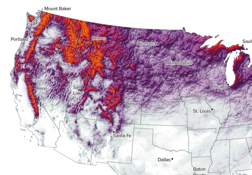
A map of snowfall totals for the 2017-2018 season. The orographic effect is largely responsible for the pattern of favored snowfall in higher terrain. Credit: Washington Post