The leading edge of a cold air mass, often produces the heaviest snowfall in a storm system.
Credit: Lutgens and Tarbuck
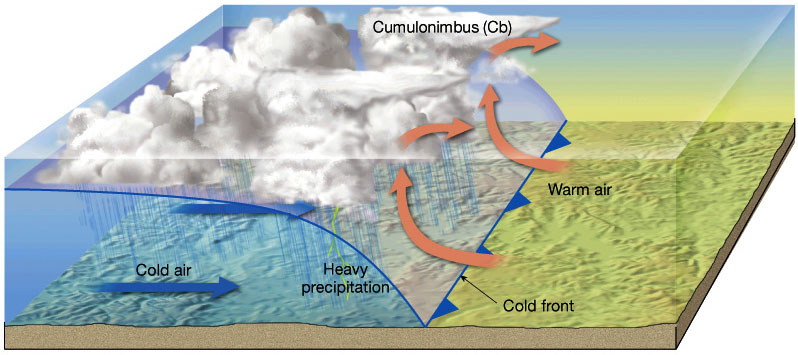
Cold fronts mark the leading edge of an advancing mass of relatively cold air. When enough moisture is present, cold fronts can produce heavy snowfall. The boundary between cold air and warm air is steep and often advances quickly, forcing the warm air to rise, cool, and condense into precipitation rather dramatically. In the Western US, cold fronts that originate from the Pacific are commonly characterized by bands of heavy snowfall with gradual clearing, lowering temperatures, and gusty winds that generally shift from southwest to northwest. Cold fronts that originate from the Arctic or Interior Canada tend to produce lighter snowfall, more dramatic temperature drops with sudden clearing, and gusty winds from the north, northeast, or east.

The passage of a cold front can produce bands of heavy snowfall if enough moisture is present. Accompanied by gusty winds, this can produce whiteout conditions. Credit: Flathead Avalanche Center.

A Pacific cold front moving northwest to southeast across the country. Credit: CBS Colorado