The leading edge of a warm air mass, often produces modest but persistent precipitation.
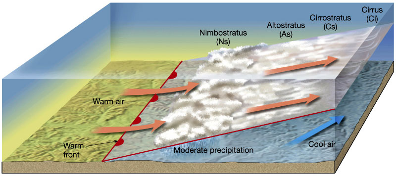
Credit: Lutgens and Tarbuck
Warm fronts mark the leading edge of an advancing mass of relatively warm air. Warm fronts move relatively slowly compared to their cold front counterparts. Warm air is gradually wedged upwards as it advances across a ramp of cold air, spreading the influence of the front gradually across a large area. In the winter, warm fronts are characterized by gradually thickening and lowering cloud cover, gradually warming temperatures, light and variable winds, and persistent light to moderate precipitation, sometimes transitioning from snow to rain. This can cause an “upside-down” storm or a rain-on-snow event.

Warm fronts can bring a mix of rain transitioning to snow to the mountains. Credit: University of British Columbia
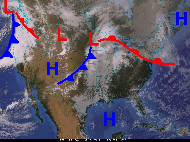
Satellite imagery showing the boundaries of warm fronts (in red) and cold fronts (in blue). Warm fronts typically move out of the south or southwest towards the north. Credit: University of Wisconsin